 Ahmed Oyenuga
There are no two identical places on earth, every area on the map is unique, this is an important point to keep in mind throughout this build, seen as the process used to build up one area on the map will need to be repeated to make up the rest of the areas on the map.
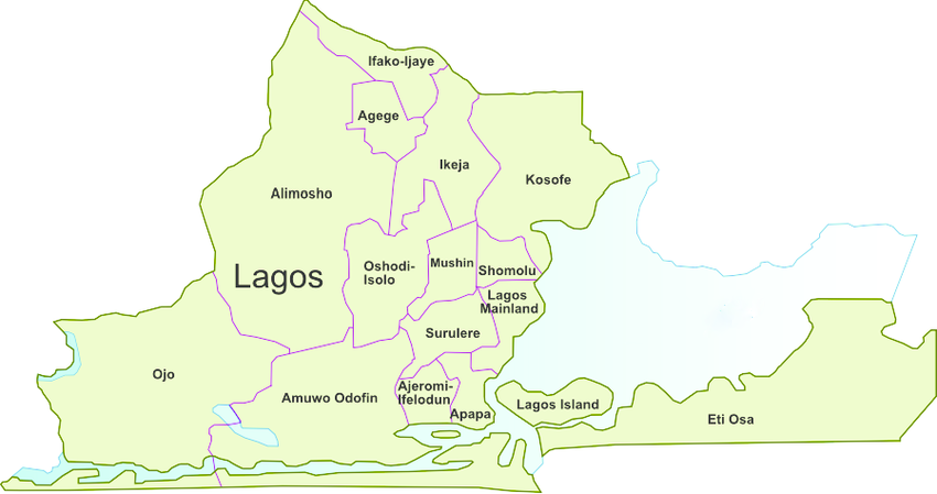
I am building the air quality map for Lagos, the state in Nigeria where I live, Lagos state has 18 main local government areas, so I’ll be making 18 map cells.
The first step I took was getting an image of the map of Lagos state, the google map is highly detailed and the areas have complex outlines which makes it a bad source for an area image as far as building an air quality map is concerned, although, I did eventually reference google maps for the one area (ikorodu) that was not represented on the free stock image I got off of google, I happen to live in ikorodu and I wasn't about to ignore it.
The next step is creating a vector outline of the areas on the map image, I found that there's no real shortcut to this process, I just had to trace the image out on a vector graphics software painstakingly, I recommend Inkscape for this, but any vector graphics software should work the same.
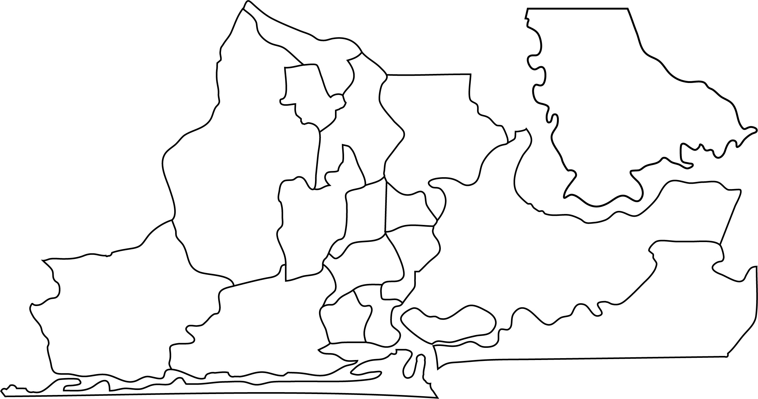
It's important to simplify the paths on the traced image, this process reduces the number of points on the vector paths, doing this will greatly help throughout the modeling process and eventually in the machining process.
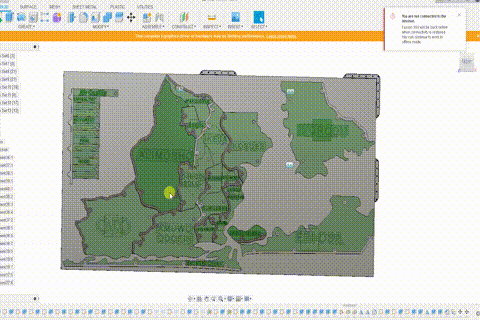
Once I had the vector graphics file as an SVG file, I imported it into fusion 360 to begin modeling the map,
I needed to figure out how to individually light the areas represented on the map, with minimal light crossover, the map is going to be built from a combination of 3d printed and CNC cut parts, so I had to consider that, although things might fit together perfectly in CAD, it probably won't work out exactly as designed in real life, so I got creative with the height distribution of the areas on the map, with the added benefit of having the map look more three dimensional, the lower areas on the map will have their touchpads embedded into the back panel, while the raised areas will have separate 3d printed holders for the touchpad.
I tried to model as many of the required features as I could, to minimize any additional manual cutting and drilling, all the required holes should ideally be machined during the CNC cutting process.
Discussions
Become a Hackaday.io Member
Create an account to leave a comment. Already have an account? Log In.