 Mirko
MirkoYesterday, I had a discussion with Wilderness International regarding my projects, as the issues to be addressed originated from them and Fauna Forever. The primary objective is to precisely measure the water level of the Tambopata River in Peru and monitor its rapid fluctuations in height. Unfortunately, they lack the resources to fund the development of such a system, although it could provide an invaluable opportunity for researching the impacts of climate change on the environment. While I am passionate about dedicating my full time to these projects (which I currently do), the reality is that I still need to cover my living expenses. Nonetheless, someone must take the initiative to kick-start this endeavor.
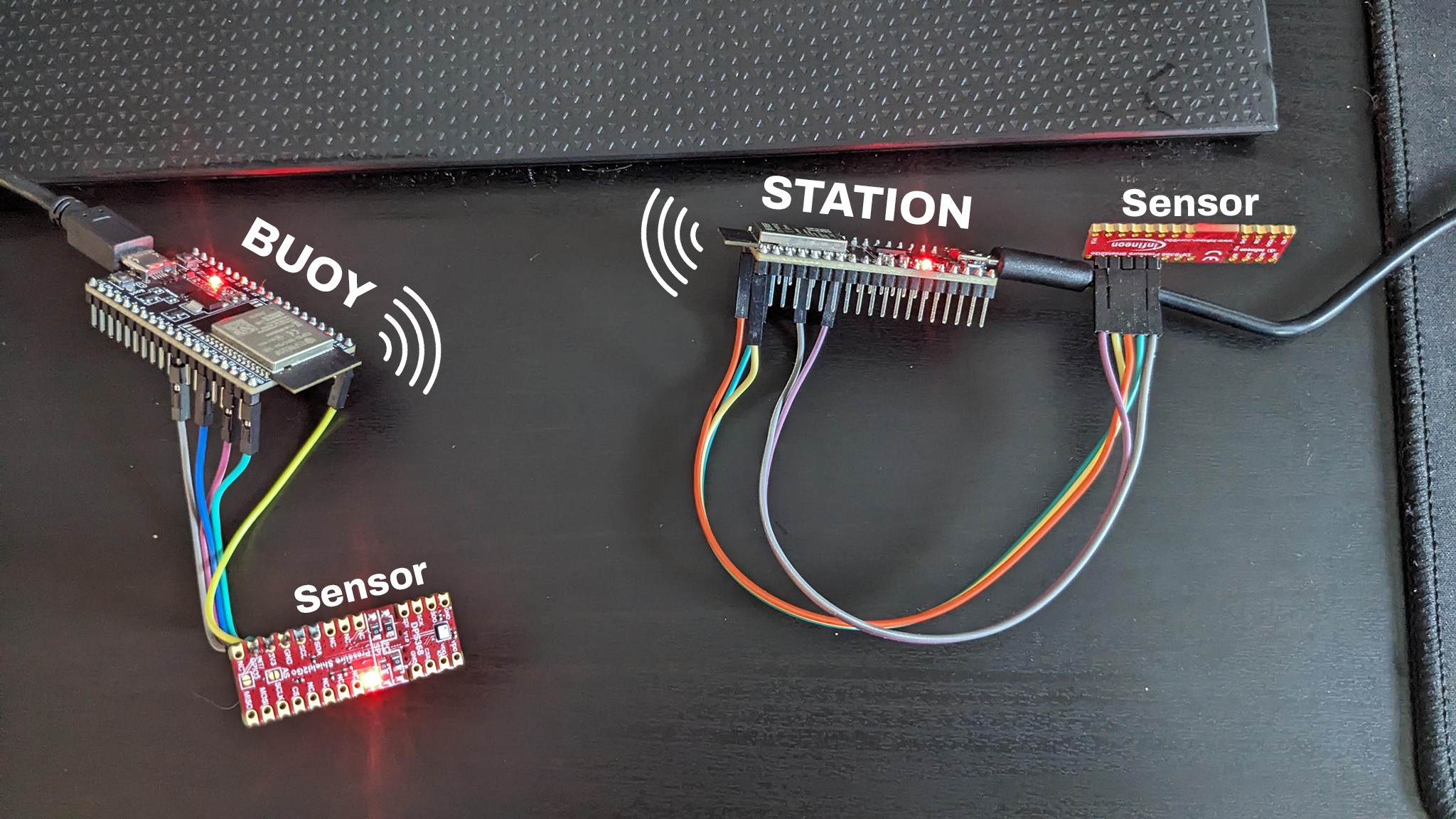
Some time ago, I initiated a Proof of Concept (PoC) and developed the code to measure pressure values from the DPS368 Pressure Sensor, calculating the height between two BLE-connected devices. With the optimal and most accurate settings, the system is already functioning impressively well, demonstrating a high level of precision.
Both the Buoy and the Station are ESP32 DevKit-based, with the DPS368 Sensor connected via I2C. Following the proposed concept, the Station measures the local pressure, while the Buoy captures the "moving" pressure. In this configuration, I employ continuous measurements without sleep (referred to as USB mode), and the Buoy transmits a value to the Station every second.
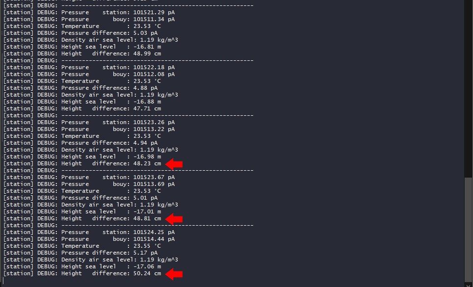
Then I move the Buoy on a scale to a height x and checked the terminal log
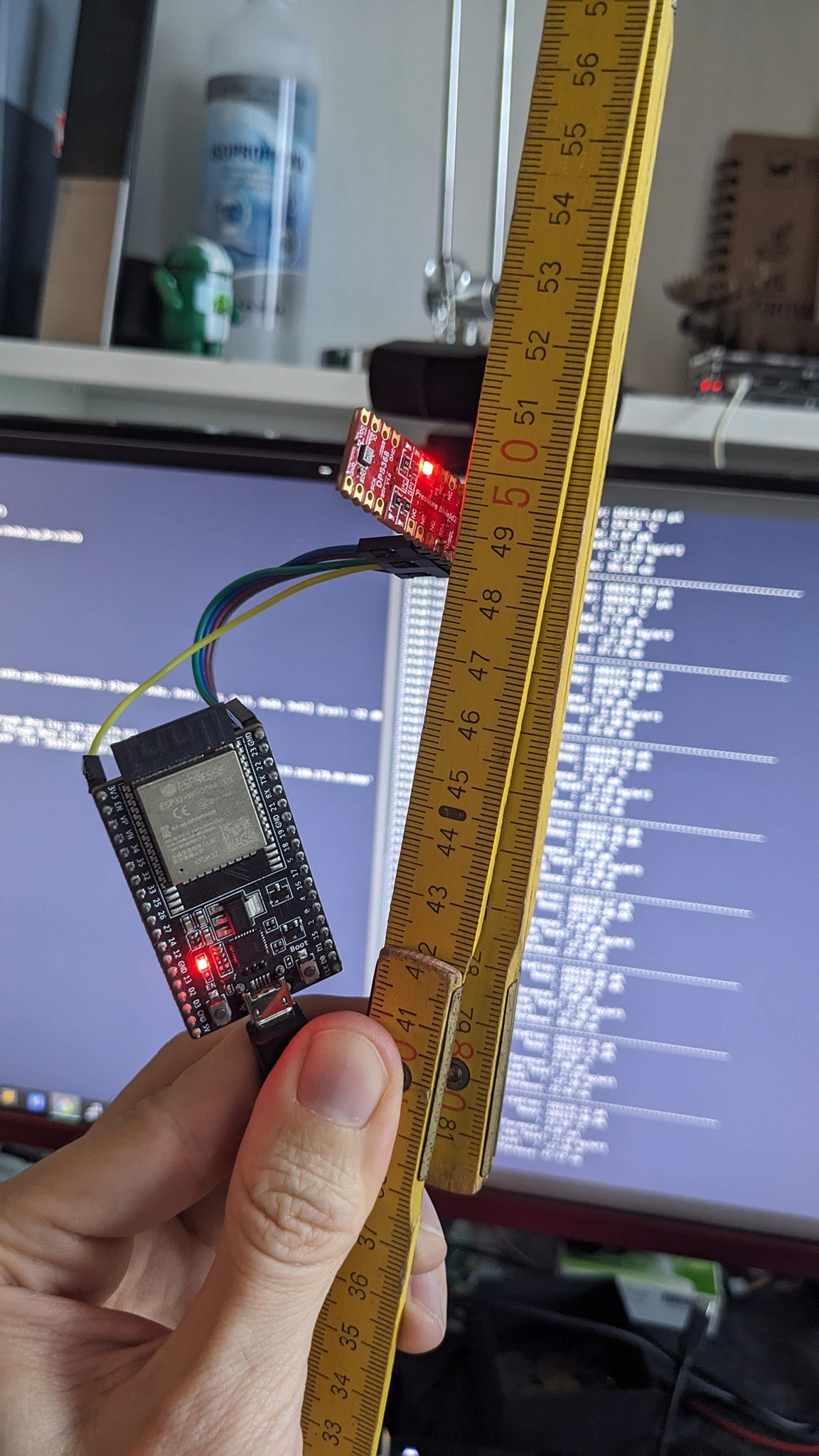
Impressively it can get very accurate with +-10cm accurracy. That is not really needed for this project but it helps to make it a good project.
Conclusion
In conclusion, the Proof of Concept (PoC) has successfully demonstrated its functionality in a controlled laboratory environment. I am optimistic that this system can perform effectively in the challenging conditions of the Peruvian rainforest along the river. However, there are several challenges that need to be addressed, such as devising a secure method to attach the buoy to prevent entanglement with debris and avoid getting stuck on sandbanks. Additionally, making the device waterproof is crucial for its durability in the field.
The use of solar power presents itself as an ideal solution for sustaining the device and eliminating the need for manual charging. To enhance the communication range, the implementation and testing of BLE long distance (coded PHY) are essential. Unfortunately, as I am not a C Developer, this task poses a significant challenge.
Despite these hurdles, I believe that with the right solutions, this project has the potential to serve as an innovative and valuable tool for measuring river water levels globally, functioning effectively as a local data logger.
I would greatly appreciate any form of support or assistance in overcoming these challenges and making this project a reality.
Discussions
Become a Hackaday.io Member
Create an account to leave a comment. Already have an account? Log In.