The application that we have developed is used to not only increase the time,cost and energy efficiency but also to aid the user in gathering the necessary data that is required to predict the outcome, hence being able to change the conditions to a more friendly outcome. For example in hectares of agricultural land where the farmer may be situated far away, he/she would be able to log the records hence taking the necessary actions for optimum environment conditions for the crops to grow in, e.g. the fertility of soil. This application is customizable according to the sensors used in each sensor node, hence can be used in various domains such as volcanic prone areas, mines, forests, oil refineries etc.
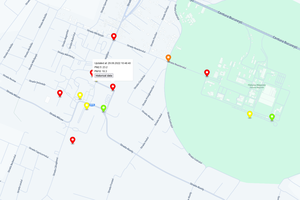
The drone (i.e. the server) will be scheduled to get data from the sensor nodes according to the user for example once or twice a day, whereas the sensor nodes (i.e. client) would read data from the environment at a more frequent pace. The user will specify the locations of the sensor nodes in the interactive web application, hence using our CRiSP (Connectivity Range in Shortest Path) algorithm, the shortest path with which the drone needs to travel can be devised.
The drone starts from the home station, communicates with each sensor node according to the way points calculated by the CRiSP algorithm, and saves the data that has been collected. The sensor node saves the data in JSON format and once it sends the data from its memory to the drone, it starts afresh after erasing the stored data that was sent. The drone, after visiting every sensor node, goes back to the home station and connects to the Cloud using wi-fi and pushes the data onto the cloud. This data can then be viewed by the user using the the web application, hence being able to take the necessary steps.
Software Used:
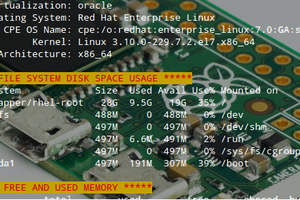
- Amazon AWS Services
- Ardupilot
 mihai.cuciuc
 Lutetium
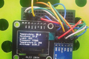
 Psyrax