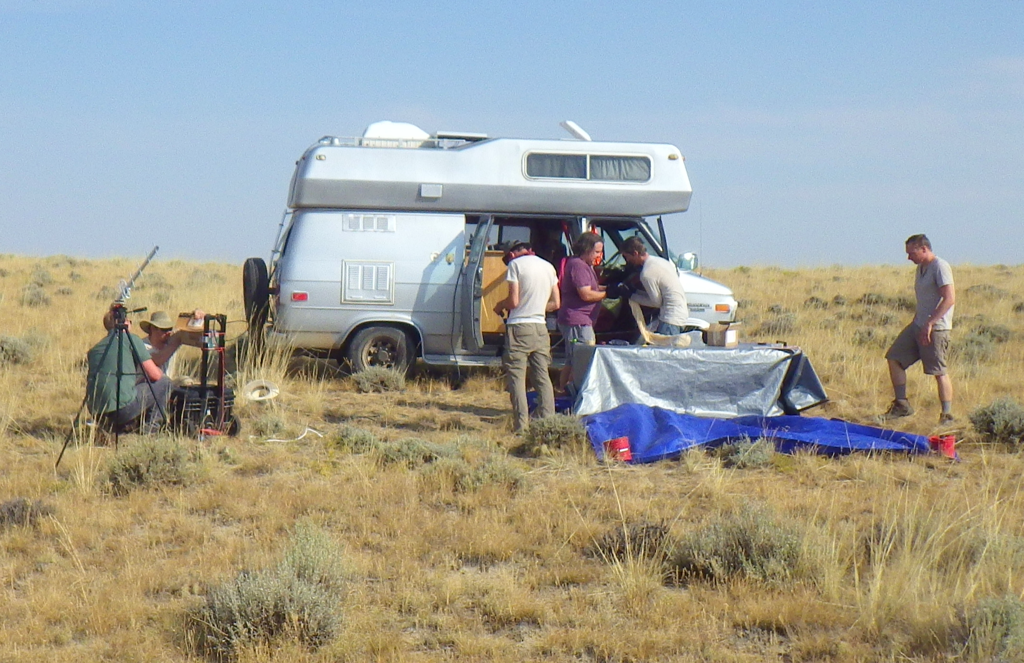
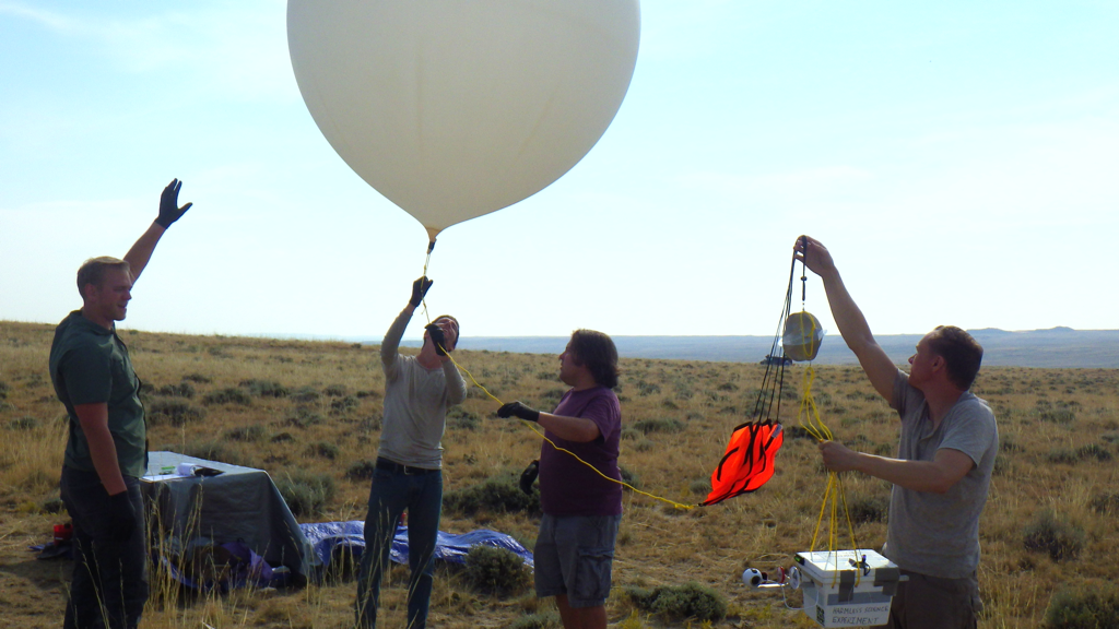
Close
0%
0%

Solar Eclipse High Altitude Balloon

Boulder's makerspace, Solid State Depot, is launching a high-altitude balloon in Wyoming during the Aug 21, 2017 eclipse.

Similar projects worth following
A HAM radio license and subsequent purchase of a Tracksoar APRS tracker led Solid State Depot member Brandon Skari to propose sending a balloon aloft during the eclipse. Joined by Tim Pegg, Andrew Bigoney and myself, our makerspace is putting the finishing touches on a balloon to be launched near Moneta, Wyoming about an hour before totality. The 1000 g balloon will be filled to burst just above 100,000' about 2 hours after launch and will carry the Tracksoar radio, two Raspberry Pi Zero-based video cameras, a 360° video camera, a custom altitude-triggered locating beacon and a version of Dave Akerman's PiInTheSky time-lapse camera with LoRa.

If all goes well, the balloon should be trackable on the web during flight (see links).

Technical specs:

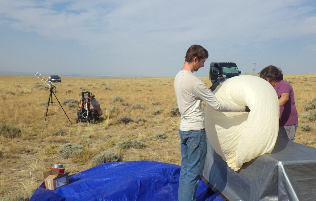
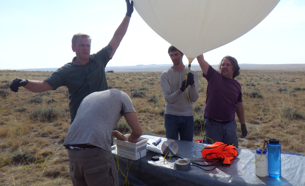
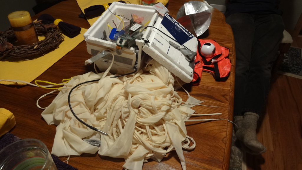
  • Balloon size: 1000g from scientificsales.com
  • Helium: ~110 cubic feet
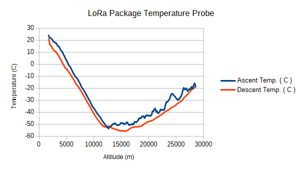
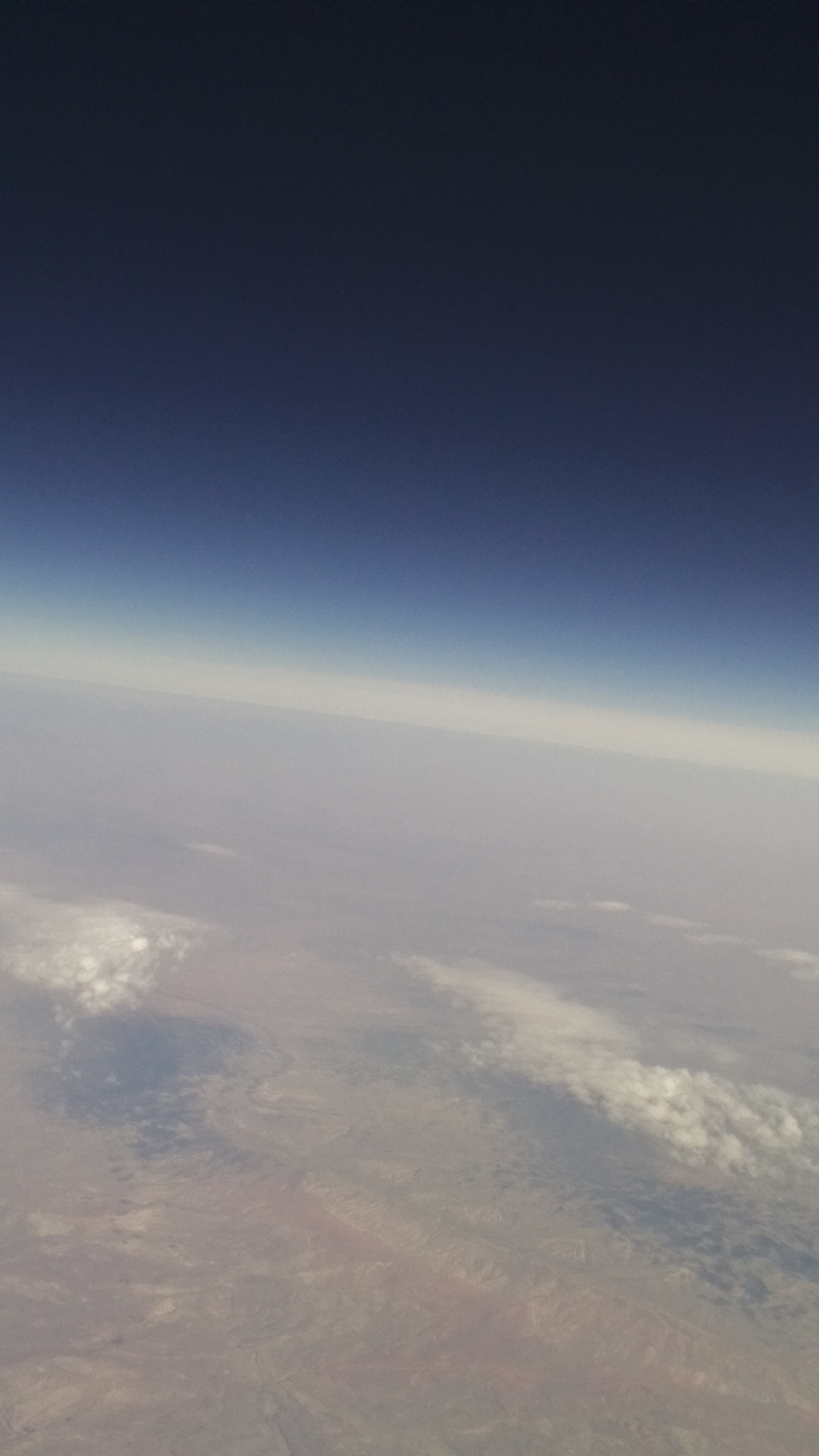
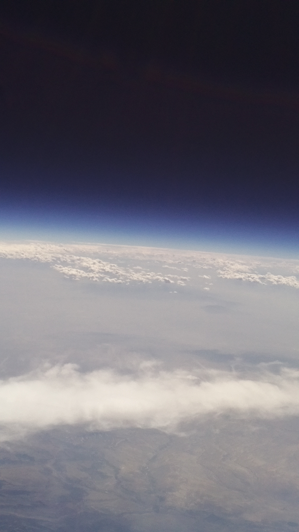
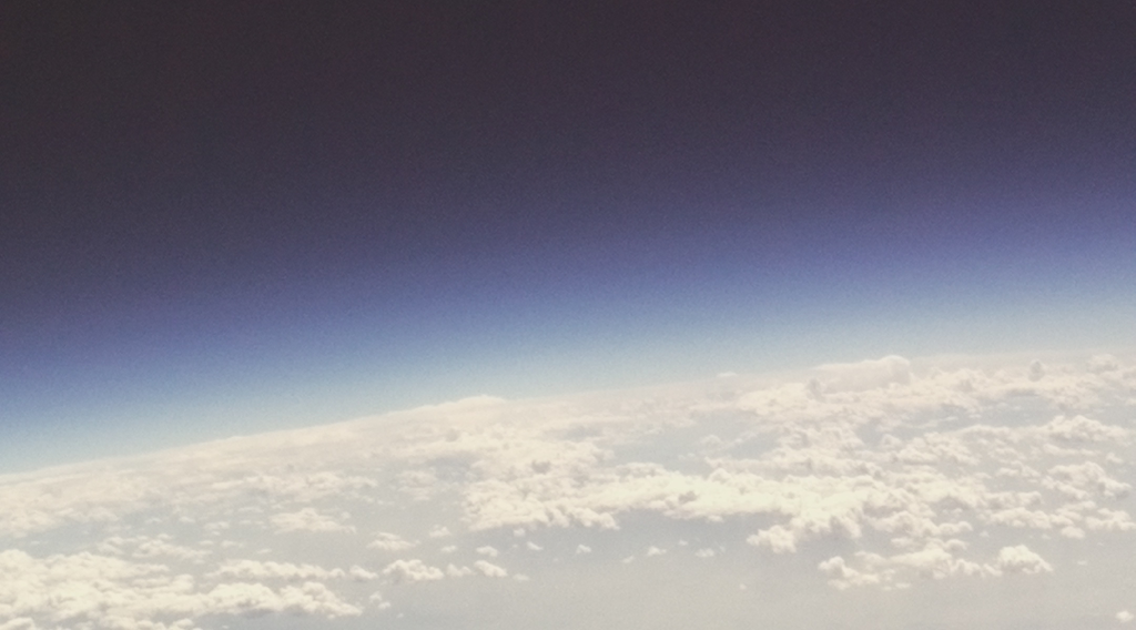
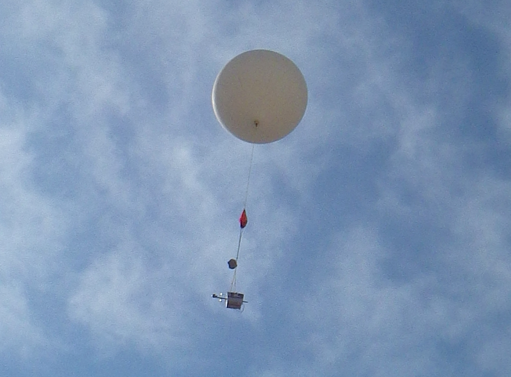
  • Estimated Burst Altitude: ~30k meters
  • Ascent time: ~2 hours
  • Descent time: ~30 minutes
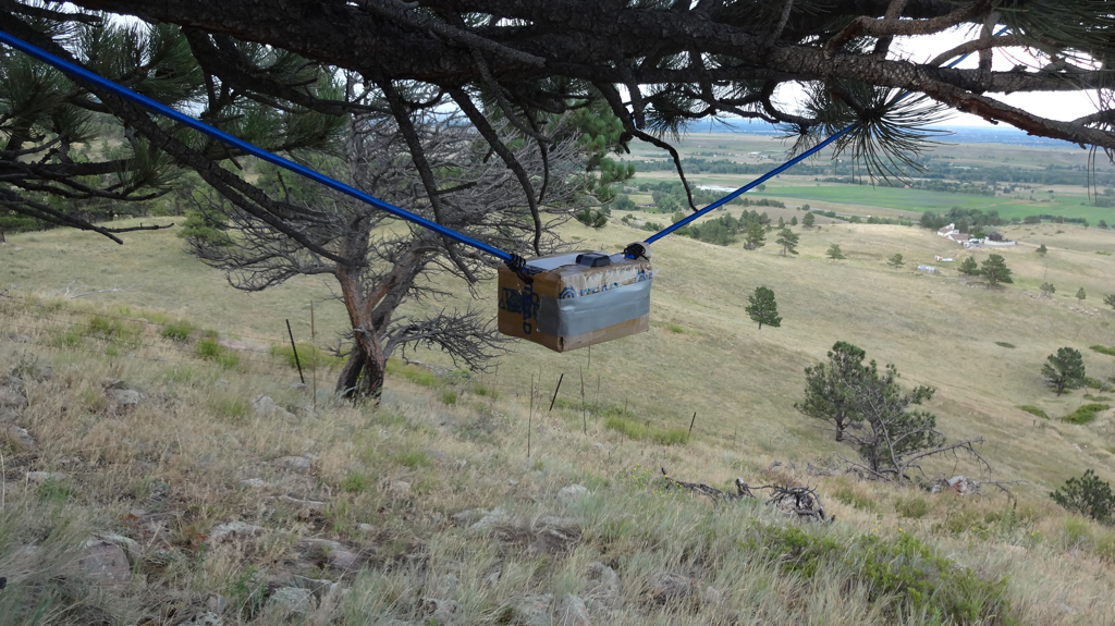
  • Payload weight: 1.1 kg
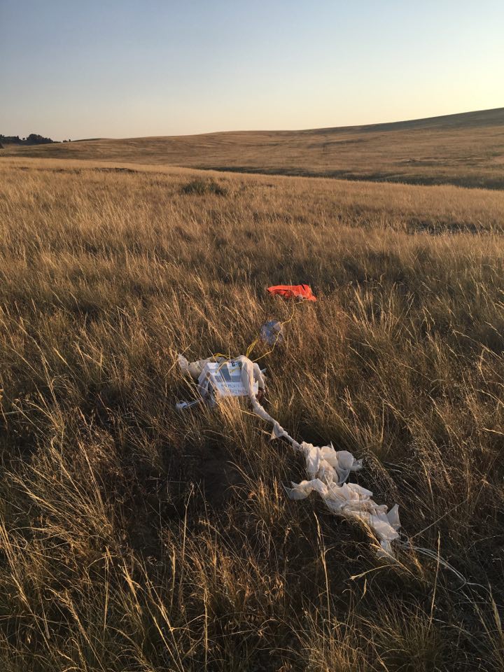
  • Parachute: 3 foot diameter
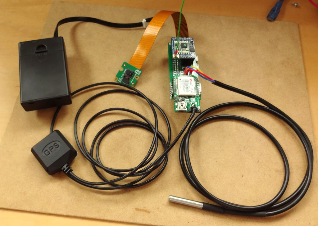
  • Cameras: 3 Pi Zero 5 MP (2 video, 1 timelapse), 1 Samsung Gear 360
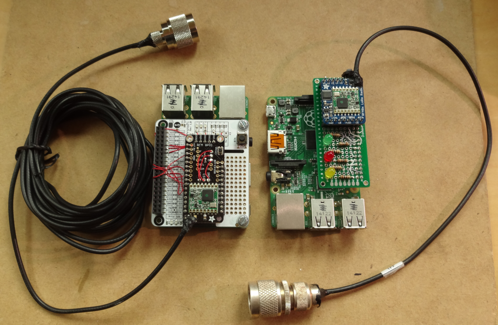
  • Transmitters: APRS 144.390 MHz, custom 40.68 MHz, LoRa 915 MHz
  • Power: 2 x 3 AA Lithium Primary packs for 40 MHz and LoRa payloads, 2 AA Lithium Primary pack for APRS, 2 USB Power packs for Pi video cameras and Samsung camera
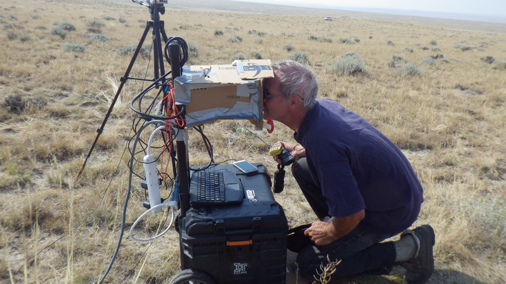
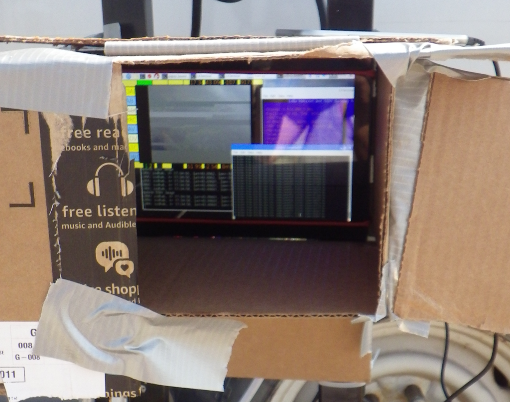
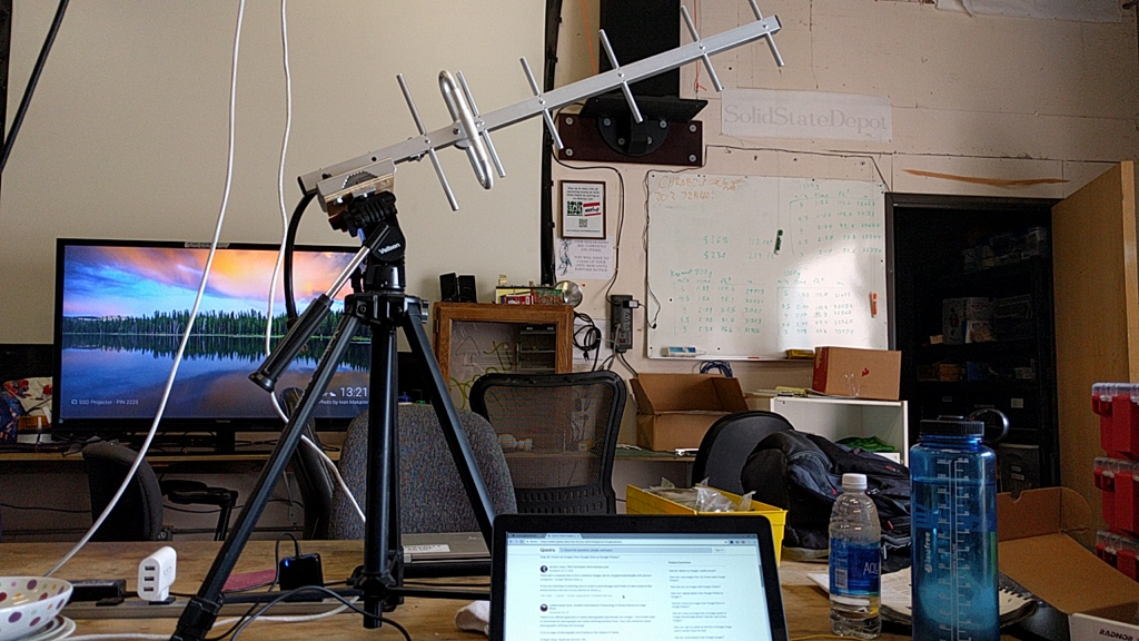
  • Receivers: Handheld 2M transceiver with PC decoder for APRS, 2 LoRa receivers with Raspberry Pi gateways, 1 portable LoRa receiver
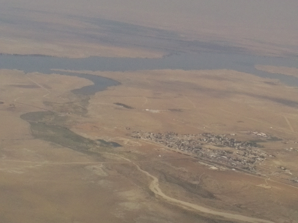
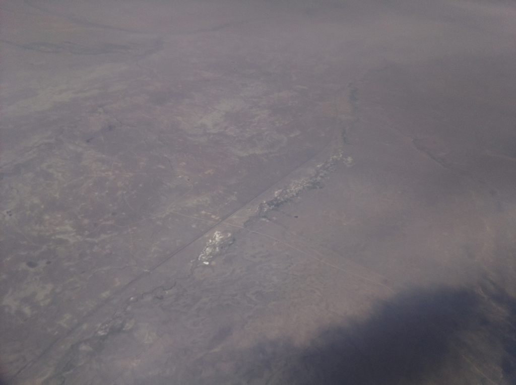
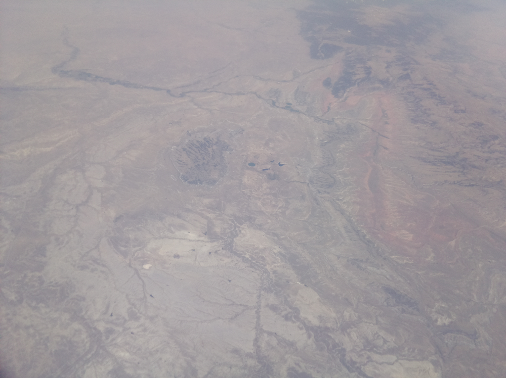
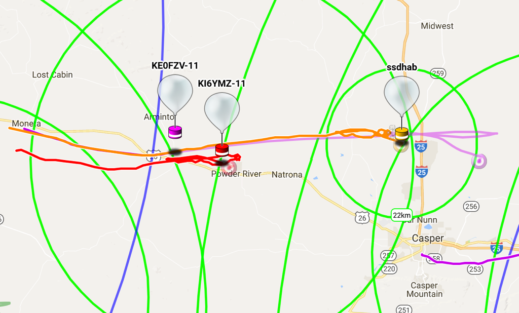
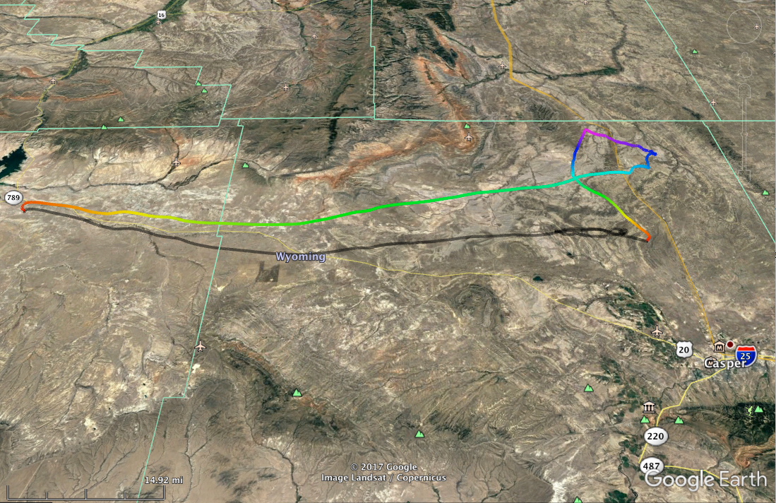
  • Launch site: ~43.1299 N, 107.9029 W
  • Launch time: around 10:40 AM (totality around 11:40 AM)
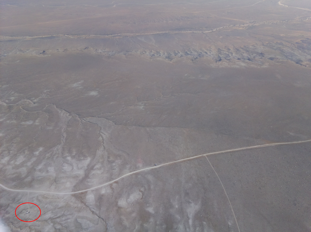
  • Estimated landing site: north of Arminto, WY

Tracking info:

  1. APRS: https://aprs.fi (look for KE0FZV)
  2. LoRa: https://tracker.habhub.org (look for SSDHAB)
  3. Images: http://ssdv.habhub.org/ (look for SSDHAB tagged images)

20170823103508-04243-map.kmz

Google earth kmz file of balloon flight

Google Earth - Zipped KML - 96.24 kB - 08/24/2017 at 00:07

Download

Secondary Recovery Beacon Schematic.pdf

Secondary Radio schematic

Adobe Portable Document Format - 123.60 kB - 08/17/2017 at 19:16

Preview
Download

  • Some analysis

    Dan Julio08/29/2017 at 19:50 0 comments

    Thanks to HaD for featuring this.  I guess I should add the bit about what we learned, what went right and what went wrong.


    First a graph of the outside temperature measured by the DS18B20 sensor.  Tim theorizes the descent temperatures may be more accurate because of increased air-flow over the sensor as the payload fell.

    We are still hoping to post 360° video.  We have it processed but the Samsung processing program stripped the meta-data that youtube wants to enable viewing.

    Things that went wrong

    1. We misconfigured the Tracksoar to enable repeating of packets which caused aprs.fi to stop logging our data after the balloon reached about 38,000 feet so we lost its track.  The android app APRSdroid has some trouble decoding packets although worked at the end as the recovery team was trying to find the payload.
    2. The balloon gained altitude much more slowly that we originally calculated it should.  It was quite as high as we wanted it during totality although we did get some interesting shots.  We are still trying to understand what went wrong and theorize that the ballasts we were using to fill the balloon to the desired lift may have been lighter than we thought (they were filled with water and perhaps there wasn't as much water in them as we thought).
    3. One of the raspberry pi's recording video (downward) had a corrupt filesystem upon recovery.  All three pi's crashed when the payload landed and it may be that the crash corrupted the micro-SD filesystem.  It's not clear why all three pi's crashed.  One of them (the LoRa) payload was connected to a 3 AA battery pack and it's possible the power was interrupted.  The other two were connected through a USB hub to a USB power bank.  It may be that the connection to the Micro-SD card was interrupted.

    Things that went right

    1. Planning paid off.  Tim and Brandon were pretty rigorous about creating setup and launch plans and making lists of everything that had to be packed for a successful launch at a remote campsite.  The launch went very smoothly and on time.  The launch site, chosen based on flight predictions, was good and the balloon followed the estimated flight path fairly well (it came down slightly further east than originally calculated).
    2. Having a backup telemetry system provided the basic landing location (the last packet was received in Casper about 700 feet in the air).  Having multiple LoRa receiving stations let us get telemetry from that payload for the entire flight.
    3. APRS was successful in the end to locate the payload.  The recovery team was looking in the general area and receiving strong APRS transmissions but had trouble decoding these with the app.  Finally one was decoded and directed them directly to the payload.  They also had downloaded a map of property owners and were attempting to contact the owner of the ranch when a friendly state police officer stopped by to see what they were doing.  He know the ranch owners and took them directly to their house where they got permission to enter the property (with an admonishment about being careful not to start any fires on the tinder dry land).
    4. Multiple cameras were able to capture some different, interesting images.  The Samsung 360 camera had troubles overheating so it was stored in a refrigerated environment until launch.  Although it only recorded 2 hours of video (still had battery power and SD-card space left), it was able to record totality.
    5. Multiple methods of communicating between teams including a messaging system (we simply had a group on facebook) and 2M HAM radios was helpful.


    Things we would change for a future launch 

    1. Improve communication abilities between teams and recovery coordination.  We ended up having to relay some instructions between various members during recovery which complicated things a bit.  We weren't able to use the directional antenna for the 40 MHz...
    Read more »

  • Flight Photos

    Dan Julio08/24/2017 at 19:05 0 comments

    This post has photos from two Pi cameras: a side-mounted camera that recorded video and took a snapshot every 10 seconds and the LoRa timelapse camera that took a photo every minute.  It was mounted pointing up from the ground at about a 30° angle.


    LoRa camera about 5 minutes after launch.

    Video Pi looking at Shoshoni, WY.


    Totality approaching.  Elevation is about 28,000 feet (8500 m).

    Totality approaching on the ground.

    Start of totality in the clouds.

    Totality.

    Totality ending.

    Totality receding.  A jet may have been following along.

    About 45,000 feet (13,700 m).  -58 F (-50 C) outside.


    About 80,000 feet (25,000 m).  -12 F outside (-24 C).

    The ground from near the highest point the balloon reached (94,000 feet/28,600 m).  It took about 3 1/2 hours to reach this.

    Just as the parachute burst.  Decent was 27 minutes.


    Just about to land.  Balloon all tangled up.

    A SSDV photo received by the launch team shortly after launch.  Some packets lost.

    A short video mostly showing the totality as seen by the Pi camera.

  • Success!!!! (Mostly)

    Dan Julio08/24/2017 at 00:06 0 comments

    It flew, it recorded, it transmitted and we got it back.  This log is just some of the pictures of our team's activity for the day.  Next post will be pictures from the cameras.  Subsequent posts will include some more detail about what worked, what didn't and what we learned.  We're also creating some videos that we'll post.


    Launch Team southwest of Shoshoni, WY


    Tim and Bryan filling the balloon.


    Prepping the payload (turning stuff on and starting the hand-warmers).


    Launch in progress.


    Up, up and away.


    Launch site LoRa receiver (handheld radios + APRSdroid were used to receive APRS - at least in the beginning).


    LoRa display (Dave Akerman's lora-gateway and lcars programs on a Pi).  Andrew built the cardboard light shield so the display could be made out.  That's a downloaded SSDV image with some missing packets.


    LoRa antenna on a very obliging Wyoming friend's house in Casper.  Pi-based receiver was powered by the 12V battery and connected to my setup in the house via WiFi.  I started getting packets in Casper about an hour after launch and between the two receivers, we monitored the entire flight, which was lucky because we had misconfigured the APRS and aprs.fi stopped logging our APRS packets after the balloon reached a certain altitude.


    The flight as recorded on habhub.org (thanks to Chrobi's hacked Pi+cell modem, the launch team had a cellular hotspot and could log the start of the flight and then I logged the end of it from Casper.  KE0FZV-11 is the APRS log before they stopped recording us (we configured our tracksoar to allow digipeaters which is illegal for airborne packets).


    Google earth plot of the balloon path.  I'll add the kmz file to our files.


    The recovery team (Sarah and her family, including two very adventerous kids, plus Bob and Kate) found the payload about 5 miles off of I-25 north of Casper.  We had a general location from a final LoRa packet received about 700 feet off the ground.  They had their 2M radios on and heard the APRS radio but APRSdroid wouldn't decode any of them until it finally did and led them right to the balloon.


    The aftermath.  The payload actually survived in pretty good condition.  I had worried, based on watching the rapidly decreasing altitude after the balloon burst, that the parachute had gotten tangled up.  It did hit hard enough to break the box and crash all three on-board raspberry Pi's - one of which ended up with a corrupted filesystem and loss of all video stored on it.

  • LoRa payload

    Dan Julio08/18/2017 at 17:53 0 comments

    The LoRa payload is based on Dave Akerman's excellent PiInTheSky system modified for USA operation.  Simple changes were made to the code to support a new LoRa configuration (1200 bps using 62.5 kHz bandwidth, EC4:6 and SF8), increase the power output and enable a temperature sensor.  The Semtech tools calculated, before subtracting losses or adding antenna gain, a total RF Link budget of about 146 dB (which shows the awesome capability of these radios).


    The Raspberry Pi-Zero based payload was based on this blog post.  It is powered off of 3 Lithium AA Primary cells and supports the Pi Camera taking high-resolution time-lapse photographs stored locally.  Lower resolution copies are also transmitted after being compressed and prepared for transmission by Philip Heron's ssdv.  A 640x480 image takes about 42 255-byte packets and the ssdv format allows image reconstruction with lost packets (the associated part of the image is simply missing).  It also connects to a Ublox GPS capable of high-altitude operation and a DS18B20 temperature sensor for external temperature monitoring.  GPS location and altitude, as well as temperature and other information is transmitted as well as stored locally.


    Two Pi-based receiver-gateways were also built based on his lora-gateway project.  One will be with the launch team and the other in Casper, Wyoming, where it should be able to connect to the UK site habhub.org for logging. 


    9 dBi Yagi antennas are connected to the Pi-based gateways and mounted on tripods.


    Finally a portable LoRa receiver was made by porting Dave's code to a Teensy-LC mounted on a 6 dBi Yagi antenna.  It's primary use will be during recovery but may be helpful during flight as a way to "find" the balloon after it is out of sight since the smaller Yagi has a wider field-of-view.


    Some distance testing was done by hanging the payload in a tree (antenna hanging down) in the foothills above Boulder and then driving east, stopping occasionally to check reception.  I got data about 37 miles out before having to turn around because it was late.

    Please feel free to contact me if you'd like more information about the build or configuration of this payload.

  • Secondary locating transmitter

    Dan Julio08/18/2017 at 04:07 0 comments

    Team member Tim Pegg, KF6LHX, designed a 40 MHz ISM band locating beacon to assist in finding the balloon using a directional antenna after it lands.  It is designed to trigger when the balloon falls below around 14,000 feet using a pressure sensor and sends two square wave tones at 700 and 1000 Hz at 40.68 MHz AM modulation.  Power output is estimated to be between 10-20 mW, enough, hopefully for a range of 500-600 feet on the ground for final localization.

    Etched circuit board

    Directional Antenna (small magnetic loop)

View all 5 project logs

Enjoy this project?

Share

Discussions

David wrote 08/29/2017 at 18:33 point

We must have been in the air right next to each other! In fact, I see my payload on a screenshot up there ;)

73, KI6YMZ

  Are you sure? yes | no

Dan Julio wrote 08/29/2017 at 19:14 point

We saw your balloon on the tracker too, although you had better altitude during the eclipse and Sarah showed us your fantastic video, David.  Thanks for the correction too.

  Are you sure? yes | no

Dan Julio wrote 08/23/2017 at 23:36 point

It was a success!  Mostly.  I'm just posting pictures now.  We recovered the balloon.  Got data, pictures and video but had a few issues.

  Are you sure? yes | no

Richard Hogben wrote 08/25/2017 at 22:35 point

Nice!

  Are you sure? yes | no

ZaidPirwani wrote 08/23/2017 at 13:24 point

how did it go ????

  Are you sure? yes | no

Similar Projects

Does this project spark your interest?

Become a member to follow this project and never miss any updates