 Capt. Flatus O'Flaherty ☠
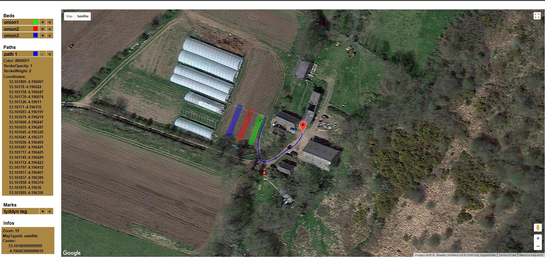
Rather than just having a clunky database for storing all the waypoint coordinates - why not have a green and pleasant Google maps based system where we can almost see the crops growing?
This is exactly what our team member Rafael Neves has done here: https://farms-geogad.netlify.com/
Now we have to get it linked to the database using MYSQL.
Discussions
Become a Hackaday.io Member
Create an account to leave a comment. Already have an account? Log In.